Site Description
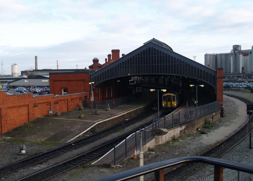
Originally the line came straight out of the tunnel and continued on to a station on Penrose Quay, which was built in 1860. To eliminate the necessity for Youghal/ Cobh line trains to reverse to enter the station, this connection was replaced by the present alignment in 1893, Penrose Quay being replaced by the present station in the process. Above the entrance to the tunnel is the site of Summerhill station, closed in 1868 when a line was built to connect the GS&WR mainline with the then recently acquired C&YR. The station, which is built on a curve, has five platforms, comprising two through lines and three south facing bays which are on the Down side at the east end of the station. There are canopies over the latter. There was previously a fourth south facing bay at the south end of platform No. 4, but this track has since been lifted. Platforms 4 & 5 are covered by an overall roof and are connected by subway. There is an avoiding curve on the Up side of the station. This was double track until 1987 and was used primarily by Anhydrous Ammonia trains to/from Marino Point until this traffic ceased. Part of the station building was used as an hotel until 1927. There was a signal cabin halfway along the Up platform which protruded out through the station wall. The station building, which is on the Down side, contains offices, shops and a ticket office. Former GS&WR 2- 2-2 steam loco no. 36 is preserved on the station concourse. The outer walls of the former goods store are on the Up side to the west of the station proper. This area has been redeveloped for non railway use. The former locomotive shed, which contains seven lines, is on the Up side at the east end of the station. Previously, there was a link to the now closed railway stations on the south side of the river Lee. This trailed in on the Up side behind the station, having run along the streets of Cork, complete with quay side sidings, traces of which remain. It was finally closed in 1976.Photographs
Photo Gallery - Cork Kent Station
Google Street View - Cork Kent Station
Geograph.ie - Train arriving from Cobh (Link checked 27072021)
Geograph.ie - Station looking east (Link checked 27072021)
Geograph.ie - Station looking east (Link checked 27072021)
Geograph.ie - ex GS&WR Engine No 36 (Link checked 27072021)
Geograph.ie - Looking towards Cork Tunnel (Link checked 27072021)
Links
Irish Rail Station Information - Cork Kent Station (Link checked 27072021)
Chronological Details
| Opened | Closed | Company | Name | Notes |
|---|---|---|---|---|
| 01/02/1893 | / /Open | GS&WR | Glanmire Road |
Geographical Details
| Section Start | Section Finish | Distance | Units | Milepost | Measured from |
|---|---|---|---|---|---|
| Heuston Station | Cork | 165.25 | Miles | 165.25 | Heuston Station |